The municipality - Les Guilleries Km0 - Sant Hilari Sacalm
Sant Hilari, also known as "The town with 100 springs", is a quiet town and, at the same time, full of activity, with a past and also a great future, which has grown in harmony with the rhythms of the land and the water. We live well, we breathe healthy air and we preserve the essence of a popular mood which makes us unique and genuine.

GEOGRAPHY
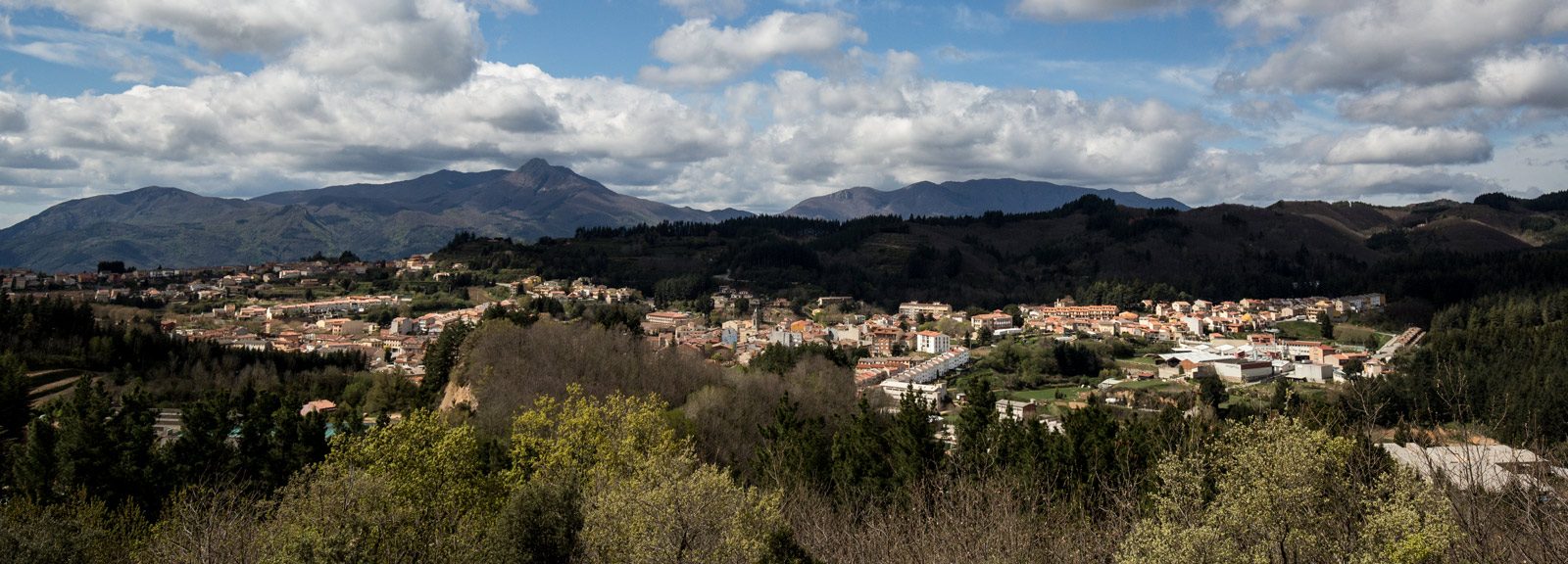
The municipality of Sant Hilari, in the west of the province of Girona, has an area of 83.56 km2 and it is the largest village in Les Guilleries. The town is over 800 meters of altitude and is surrounded by Les Guilleries massif, being the summit of Sant Miquel de Solterra (or de les Formigues) the highest peak. It belongs to Vic’s bishopric, because in the past it belonged to the “Osona’s Mountains”; judicially, it depends on Santa Coloma de Farners.
The municipality has an elongated shape to the north and reaches the other side of the river Ter, in Susqueda reservoir. It is surrounded by the municipalities of Susqueda, Osor, Santa Coloma de Farners, Arbúcies, all of them belonging to the region called La Selva; and by the municipalities of Espinelves, Vilanova de Sau and Rupit, from Osona. It has the old municipality of Querós and the parishes of Santa Margarida de Vallors and Montsolís.
The population is practically entirely concentrated in the town of Sant Hilari Sacalm, except for farmhouses or small scattered villages, but of little importance due to the amount of inhabitants. Examples are Cal Sastre, El Serrat or Santa Margarida de Vallors.
The municipality is extraordinarily forest, located in the nucleus of Les Guilleries, and Sant Hilari Sacalm is its capital. It is a massif located at the apex between the Catalan Prelitoral Range and the Catalan Transversal Range, and it belongs to both mountain ranges. It is located on La Selva’s western boundary, and on Osona’s eastern boundary.
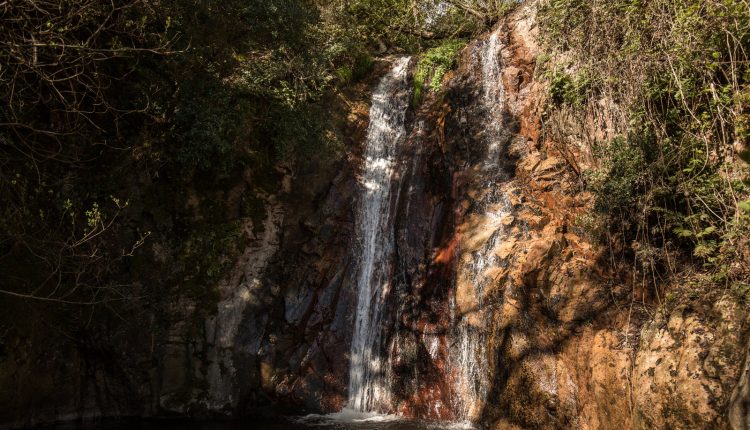
Together with the forest mass, water is the other wealth of great importance for the municipality, establishing in more than one hundred the number of springs that spring in its territory. Its orography allows water to be all retained and to feed its aquifers. Therefore, in rainy seasons, the amount of evaporated water is insignificant compared to that filtered and the rest, which flows through the large number of streams.
WEATHER
We can say altitude is one of the dominant factors when explaining the climatic characteristics in Sant Hilari, because starting at 500 meters of altitude the effects of the decrease of the temperature and the increase of rainfall begin to be noticed. Climate is considered to be a type of Mediterranean mountain climate, but its characteristics are similar to the Atlantic climate.
As for the temperatures, during the winter the thermometer drops quite a few days from zero and snowfall is also present in December, January and February, even later on. Summer keeps temperatures cool: during the daytime, it is fine, but in the evening it is necessary to wrap us up warm. These are the characteristics that make people from much warmer places come to spend the summer.
In terms of rainfall, Les Guilleries has a higher amount of rainfall due to its orientation.
It is difficult to frame the climate of Sant Hilari within the basic climatic divisions: we have Mediterranean and Atlantic vegetation, rainfall is high, temperatures are not at all high, etc. We can say that the climate is cool in terms of temperatures, and quite rainy. However, there are now a number of variations on the general characteristics.
For further information about the weather: Meteo Guilleries and Sant Hilari Webcam.
SERVICES AND SHOPS
Every Sunday you can find the weekly market from 9 am to 2 pm in Plaça de l’Església (the Church Square) and in Plaça Mossèn Jacint Verdaguer.
Moreover, if you walk through the town centre, you can find out and buy in the different shops, where you can find, among others, local products. Discover the shops in the following link.